
This Greek-American collaborative project funds research on the Stone Age discoveries around the village of Plakias in southwest Crete (Greece). It began in 2008 with the Plakias Mesolithic Survey where both Mesolithic (11,000– 9000 B.P.) and Lower Palaeolithic sites (1.5 million years–250,000 years ago) were found.
These artifacts not only represent the earliest tools ever discovered on Crete, they also demonstrate very precocious sea faring abilities by our pre-Homo sapiens ancestors. The goal is to fund further archaeological and geological research into these early phases of prehistory in the region.
Presently the project’s research focus has two goals. The first is to continue an excavation of a Mesolithic site (Damnoni Excavation) and the second is intensive geological research to acquire absolute dates for the Palaeolithic artifacts found in the area. This is a continuous research project that is exposing dramatic new light on the earliest hominid history on Crete. Donations are used for both the archaeological and geoarchaeological research of the region, including, but not limited to, research supplies, equipment, personnel expenses, and promotion.
-

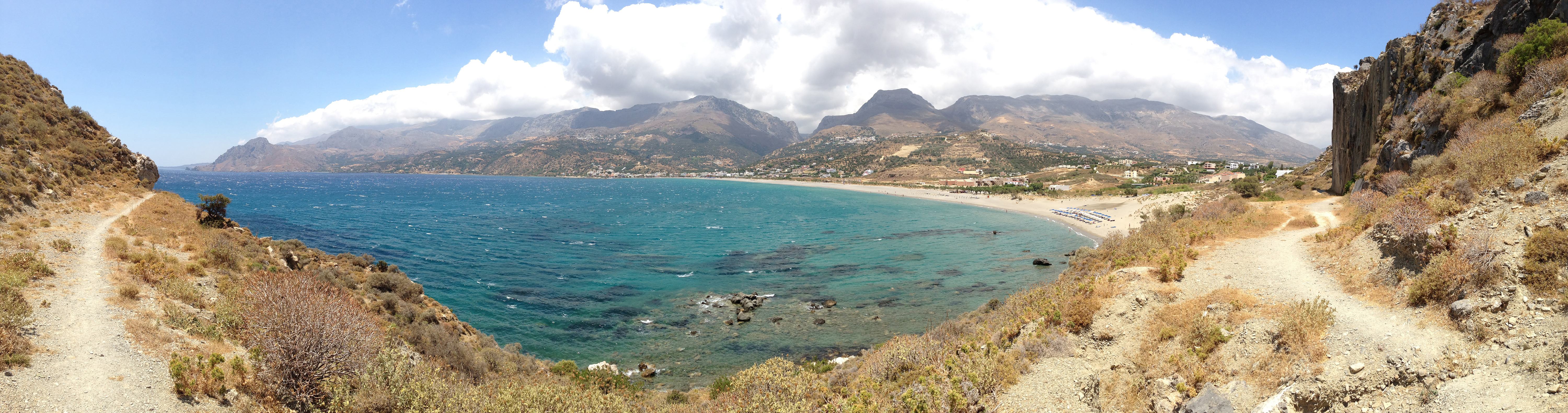
- View of Plakias Bay from west.
-
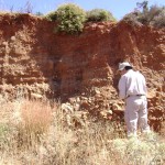
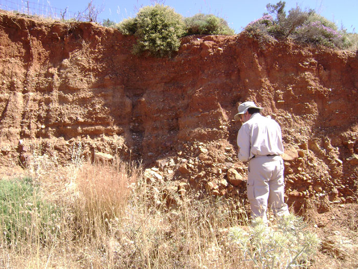
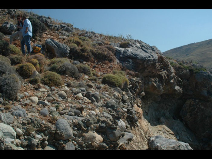
- Curtis Runnels evaluating paleosols.
-
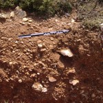
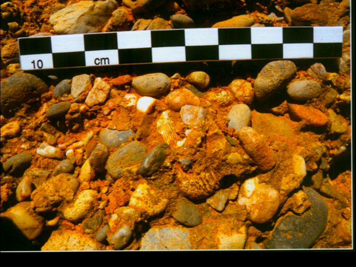
- Quartz artifact in paleosol.
-
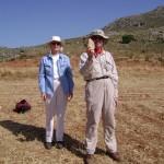
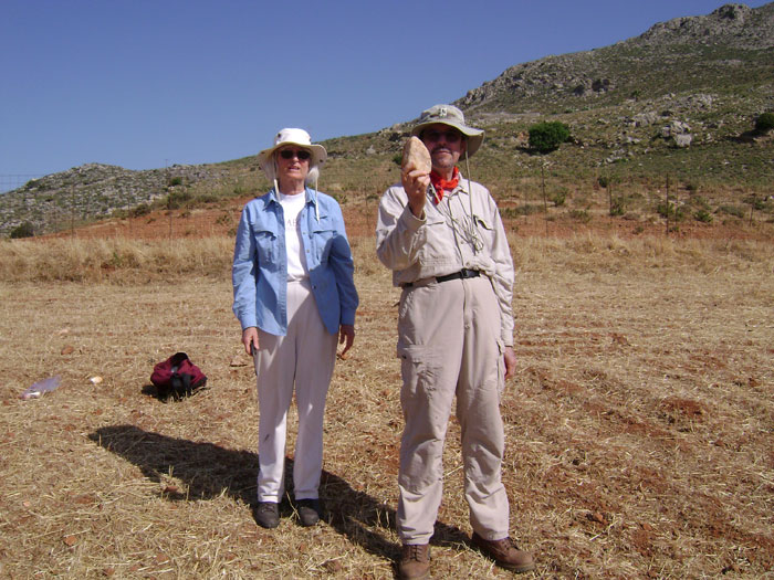
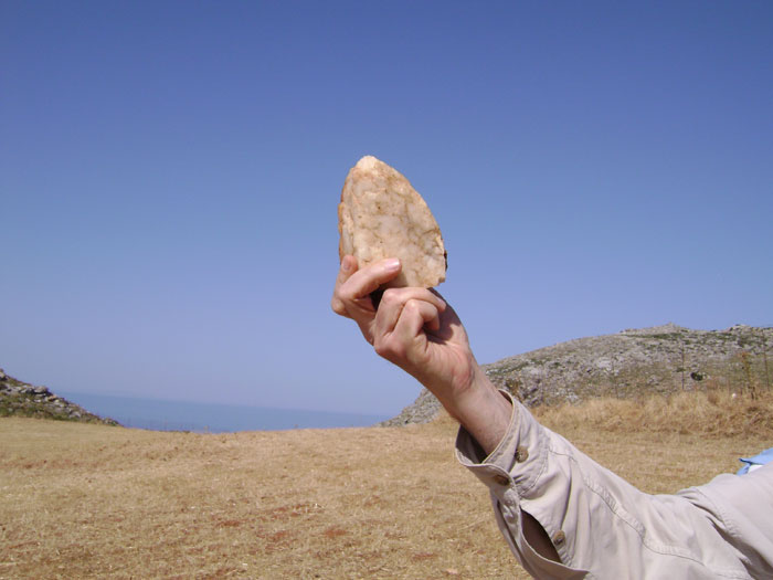
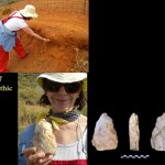
- Priscilla Murray and Curtis Runnels, who hold a biface that Priscilla just discovered at Preveli 7.
-
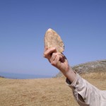
- Preveli 7 tool.
-
- Hannah Johnson and Nicholas Thompson taking shell samples from marine terraces.
-
- Raised beach (i.e., a marine terrace) in center of photograph. Notice the rounded beach cobbles now cemented and lifted above the sea due to tectonic activity.
-
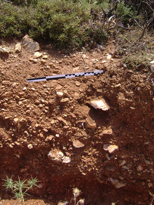
- Close-up of a raised marine terrace on the east flank of the Preveli Gorge. Notice the shell and water-worn pebbles. These occur at over 90 meters above sea level.
-

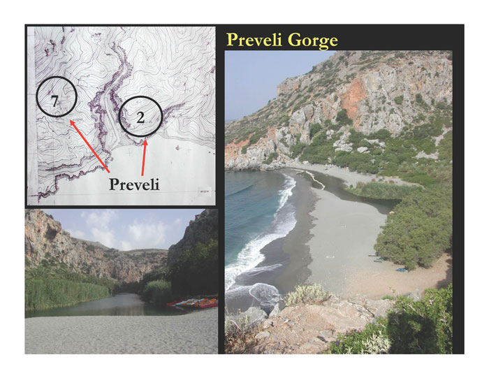
- Photograph of Preveli gorge with locations of Palaeolithic sites Preveli 7 and 2.

-

- Map of Preveli sites 2 & 7, and photos of the gorge.
-
- The marine terraces, with dates, on the east flank of the Preveli Gorge. Notice the wave notches associated with the marine terraces (i.e. fossilized beaches raised by tectonic activity).

-
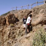
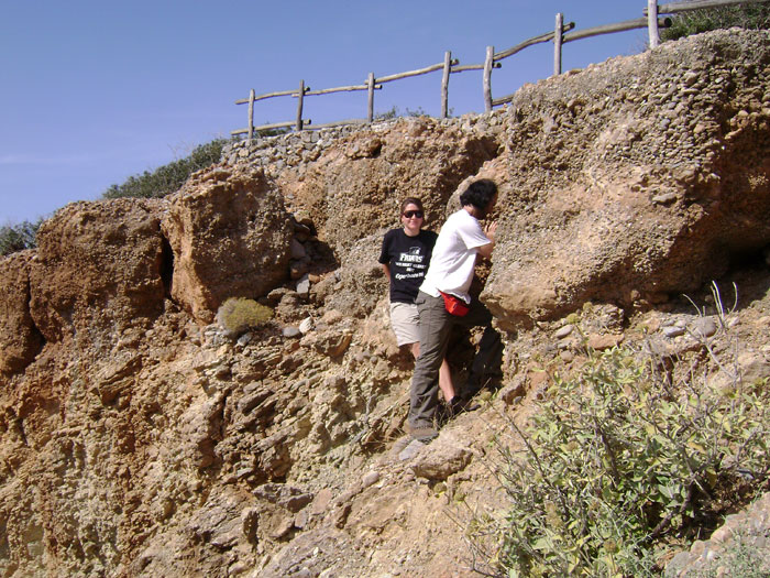
- Team analyzing one of the marine terraces (Preveli 2) from which Palaeolithic tools are eroding.
-
- Dr. Panagopoulou finding Palaeolithic tools in terra rossas at Preveli 7.

-

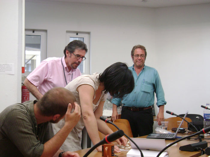
- Lithic analysts (Curtis Runnels and Eleni Panagopoulou) discuss the artifacts with a geologist (Floyd McCoy).

-

- Runnels and Strasser lecture to the archaeology students at the University of Crete – Rethymnon.
-

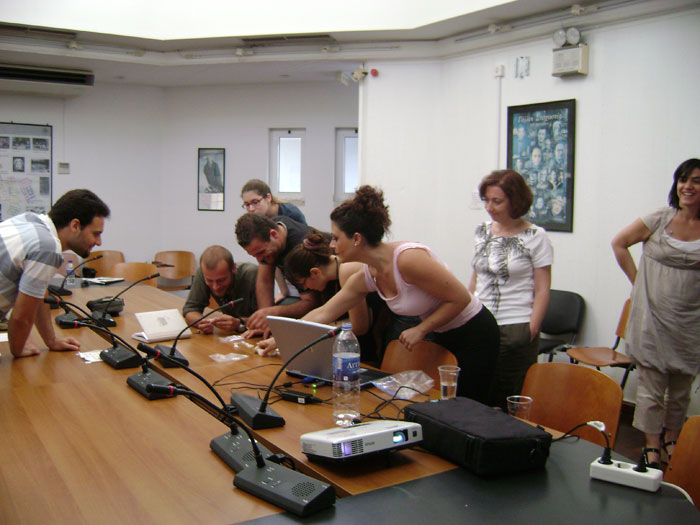
- The archaeology students at the University of Rethymnon study Mesolithic tools.
-
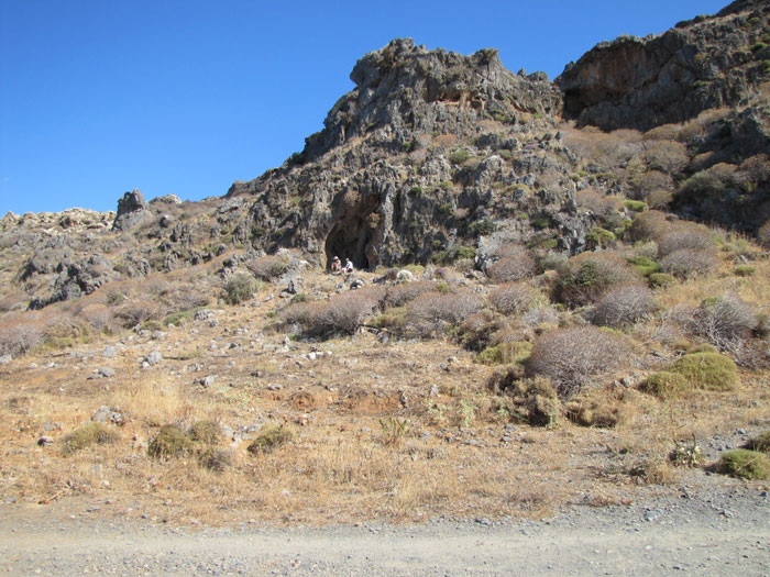
- The Mesolithic cave site of Damnoni 3 before excavation.
-
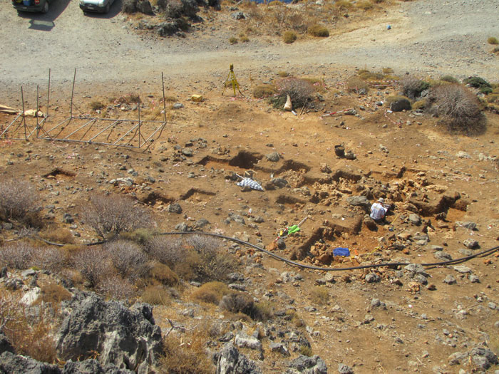
- A view of the excavation at Damnoni 3.
-

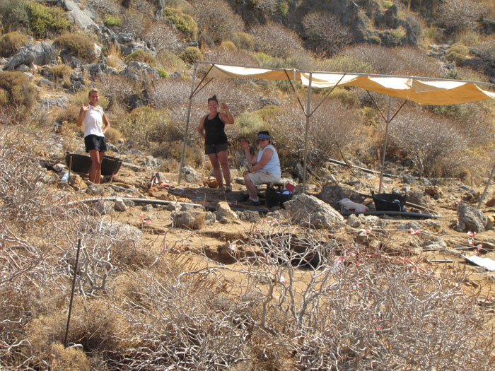
- Greetings from the some members of the excavation team at Damnoni 3 (from left, Althea Ruoppo, Kylie Waltz and Rebecca Mersereau.
-

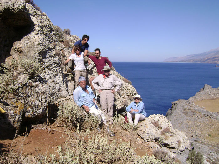
- The survey team of 2009 (from top clockwise, Chad DiGregorio, Nicholas Thomason, Curtis Runnels, Priscilla Murray, Thomas Strasser, and Hannah Johnson.
A Synopsis of the Survey and Excavation
Though claims for pre-Neolithic artifacts on Crete have been made for many decades, the Plakias Survey is the first project to identify Mesolithic and Palaeolithic artifacts in datable geologic contexts. The survey identified twenty-eight sites associated with caves and rock shelters and collected a sample of just over 2,100 lithics attributable to the Mesolithic and the Lower Palaeolithic. Since Crete has been an island for over five million years, these findings have great implications for the history of sea faring in the Mediterranean. Here we present the artifact assemblages and the details of their geological context and dating. In 2008 we found the Stone Age artifacts, so in 2009 we devoted much of the season to conducting geological analysis to provide datable contexts, and we have a terminus ante quem of more than one hundred thousand years B.P for the Palaeolithic tools. We conclude with a brief description of our findings of an excavation at a Mesolithic site.
It seemed likely that evidence for the Mesolithic period would be found on Crete because it had been discovered on other islands in the Aegean. Discoveries on Cyprus, Alonnisos, Kythnos, and other islands have shown that a previous model that argued for no pre-Neolithic occupation of the islands was incorrect. Members of the team who work on the Greek mainland developed a Mesolithic site-location model, and it was used to identify areas likely to have early Holocene sites. It was reasoned that if Mesolithic foragers found these smaller islands attractive for subsistence, Crete must also have been a desirable habitat. Crete, however, is a very large island, which raised the question of where to look for the pre-Neolithic. We searched for habitats that were preferred by foragers and that could also preserve their artifacts. The coastal area around Plakias has characteristic environmental features, such as limestone caves, proximity to coastal wetlands, and steep bathymetric drop-off. On the Greek mainland these environmental features were found to be predictive in discovering Mesolithic sites. In addition to using this model, it was possible to involve lithic specialists who were familiar with Mesolithic assemblages.
We examined all caves and rock shelters found near the mouths of fresh water perennial streams and rivers flowing into the Libyan Sea. Scatters of lithic artifacts were found on the slopes directly below the openings. The project’s primary goal was to determine the presence or absence of Mesolithic. Consequently, it was sufficient to make relatively small collections of representative lithics from each site.
The principal raw materials are massive quartz and to a lesser extent various types of chert. They are local. Cobbles of quartz and chert are visible in streambeds and on beaches throughout the area. Massive quartz is abundant in the survey area and more readily available than the rare, small, poor quality chert, and it was used for the manufacture of the majority of the Mesolithic and Palaeolithic artifacts. The appearance of the quartz ranges from milky, translucent and white with a pearly luster to a rather dull, opaque material with streaks of brown, and a blocky structure making the recognition of conchoidal fractures and flake removals difficult to the non-expert eye. These are difficult to photograph. The quartz, however, can be knapped, and our experimental flint knapping duplicated the manufacture of stone tools morphologically similar to the artifacts that we found. We believe the failure to recognize pre-Neolithic sites on Crete is the result of the difficulty in recognizing quartz tools, as well as the lack of using targeted surveys. Chert does not appear to have been used to manufacture Palaeolithic artifacts, but does occur in small quantities in the Mesolithic assemblages. The local chert nodules are probably far too small for the large tools made in the Lower Palaeolithic.
A microlithic industry was found on 20 sites and shares reduction techniques and morphological types with the Mesolithic industries from excavated sites like Franchthi Cave and Klisoura Cave 1 in the Argolid, Theopetra Cave in Thessaly, Sidari on Corfu, and Maroulas on Kythnos. Among the tools the most common types are microliths, end scrapers, notches, denticulates, truncations, borers and combination tools. The Plakias industry has affinities with both the Lower and Upper Mesolithic at Franchthi Cave, but it would be hazardous to attribute any of the sites to one or the other of these specific phases. But there are other good arguments for assigning the Plakias tools to the Mesolithic in the early Holocene — ca. 9,000-11,000 years ago. The assemblages appear to belong to the Mesolithic industry on technological and morphological grounds. If the industry were Upper Palaeolithic, one would expect to find evidence of prismatic blade reduction in the form of characteristic cores, crested blades, and core tablets, large numbers of backed blades and bladelets. On the other hand, if the industry were mixed with later Neolithic or Bronze age assemblages one would expect to find prismatic cores, crested blades, and pressure-struck blades, along with tanged or hollow-based arrowheads, and the use of obsidian and imported chert, all of which are absent from our sites. The absence of polished stone axes, ground stone querns, clay or stone spindle whorls, and characteristic ceramic wares of Neolithic or later type strongly argues against a post-Mesolithic age for the Plakias industry. Finally, characteristic artifacts of Mesolithic type were observed at several sites in situ in paleosols that are reddish brown with sub-angular blocky peds and thin but common clay films, consistent with Soil Maturity Stages 2 and 3 that date between 6,000 to 10,000 years ago.
Lithic artifacts of Palaeolithic type were collected from nine sites. Palaeolithic artifacts are distinguishable from the Mesolithic ones by their larger size as well as by technological and typological criteria. The tools include bifaces (hand axes) of triangular, sub-triangular, cordiform, and ovate forms; as well as cleavers, and scrapers. The bifaces average ca. 13 cm in length. As noted, the knappers were working with a raw material that had unpredictable flaking qualities; it is often blocky and rough in texture. As a consequence, compromises had to be made. The blanks for the bifaces are side-struck or corner-struck flakes with wide, thick, plain or dihedral platforms. The retouch is invasive, shallow, irregular, and discontinuous. The massive quartz is often of poorer quality than the quartz used in the Mesolithic that is translucent, lustrous and fine-grained.
The Palaeolithic materials resemble the Acheulean sensu lato. Until now there has been no certain evidence of Lower Palaeolithic seafaring in the Mediterranean. The absolute dating of the industry presents a considerable challenge, not the least because of the long period of time that may have elapsed since the occupation of the earliest sites allowing post-depositional natural processes to obscure the record. We used a combination of dating methods including Marine Isotope Stages, Carbon 14, and Soil Maturity Stages.
The underlying geology of the region affected our archaeological research in numerous ways. The most important geologic process is the ongoing tectonic uplift of the area. The south-facing slope is the result of uplift by the African tectonic plate going under and pushing up the European plate. Hence, the older geological strata, in terms of being above the water, are higher – though there have been severe fluctuations in the sea level throughout the Pleistocene. The combination of tectonic uplift and fluctuating sea levels over the millennia make the dating complex. Other processes, such as the formation of cemented sedimentary beach deposits (i.e. marine terraces) formed during sea level high stands and preserved by subsequent eustatic sea level regression coupled with tectonic uplift, have helped to preserve evidence of prehistoric human activity within them. The strongly cemented late Pleistocene deposits, especially the sedimentary beach conglomerates observed at Preveli, are associated with lithic artifacts. In other cases, paleosols contain artifacts of Palaeolithic type.
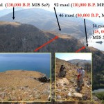
The sites of Preveli 2 and 7 are the most important sites for dating the Palaeolithic. Preveli 2 is on an uplifted limestone block, the seaward face of which has a flight of marine terraces marked by wave-cut cliffs associated with sedimentary beach deposits that date to the Upper Pleistocene. Palaeolithic artifacts are associated with the marine terraces. The lowest elevation is a late Pleistocene marine terrace at 14 meters and has a calibrated radiocarbon date of over 45,000 years B.P., and is correlated with Marine Isotope Stage 3.3. Marine Isotope Stages correlate to, and thereby date the various glacial and interglacial periods in the Pleistocene. We found artifacts in the higher terraces at 46 and 92 meters, and they are unquestionably older. But how much older? They are beyond the limits of Carbon 14. If we assume a similar rate of uplift based on the age and elevation relationships to the dated 14 meter terrace, it is possible to estimate the approximate ages of the higher terraces associated with artifacts. Artifacts associated with the terrace at 46 meters could correlate with Marine Isotope Stage 5a, ca. 80,000 B.P. The higher terrace, at 92 meters, may belong to Marine Isotope Stage 5c, ca. 110,000 B.P. It should be stressed that these are rough approximations and these ages are probably minima, and we believe they are termini ante quem. If the uplift rate is changed, the terraces and the artifacts associated with them could be much older.
On the west flank of the Preveli Gorge is Preveli 7, at an elevation of ca. 120 meters. The site is on the edge of a small basin. On the north edge is a thick but narrow remnant of re-deposited terra rossa. It is a well-preserved paleosol with a Bt horizon exhibiting the characteristics of a highly mature soil (Maturity Stage 6). The soil has a prismatic, platy structure, thick pervasive clay films, and a deep magenta color. Artifacts were found cemented in the Bt horizon. Still other artifacts of the same type are found on the surface of the eroding Bt horizon and are clearly derived from it by recent erosion, as can be seen from the red stains and sometimes adhering soil material on the artifacts that testify to their former context.
Soil Maturity Stage 6 correlates to Marine Isotope Stage 6. Together these observations suggest an age of ca. 130,000-190,000 B.P. and serve as anotherterminus ante quem for the artifacts embedded within them. The stone tools were incorporated in the paleosols as part of the pedogenesis process. The top of the Bt horizon itself would move gradually upward as a result of slow deposition, so engulfing any artifacts laid down on former land surfaces above it. Since much of the clay is air-born, the Bt horizon will increase in thickness through time slowly engulfing the stone tools that were formerly in the A horizon.
The dating of the Palaeolithic sites is based on geologic data derived from the study of marine terraces and paleosols, and these data place the Palaeolithic artifacts firmly in the Pleistocene, and probably no later than ca. 130,000 B.P.
The presence of Lower Palaeolithic sites points to an early period of seafaring in the Mediterranean, with implications for the colonization of Europe by early African hominins. Where did the Plakias Palaeolithic originate? On the present scanty evidence, an African or Near Eastern origin is as likely as an Anatolian or mainland Greek one. Wherever it originated, the Plakias Palaeolithic has implications for our understanding of hominin dispersals. It has been thought that the Acheulean reached Europe via the Near East, passing through Anatolia, and through the Iberian Peninsula directly from Africa, perhaps carried by Homo erectus or Homo heidelbergensis populations. This view of the peopling of Europe by land clearly needs to be rethought in light of the Cretan evidence. While early hominins may have reached Turkey via the Near Eastern corridor, it is clear that there could have been sea routes crossed by long-distance seafarers moving at will throughout the Mediterranean.
Once early hominins reached Crete, was their exploitation of the region continuous or intermittent? What effect did they have on the endemic flora and fauna? As with the Mesolithic, these questions must remain unanswered for the moment, and it is evident from the richness of the finds and the smallness of the survey area that a great deal more research must be done on Crete. Nevertheless, these new discoveries compel us to consider the full significance and potential impact of early seafaring on the peopling of the Mediterranean, Europe and the world.